

Ponderosa Pine
The ponderosa pine (Pinus ponderosae scopulorum) is the most widely distributed pine in North America and occupies a vast area in the West. Ponderosa pine forests, woodlands and savannas occupy approximately 2 million acres in Colorado or 8 percent of the state’s forested land.
Click on the map to view full size
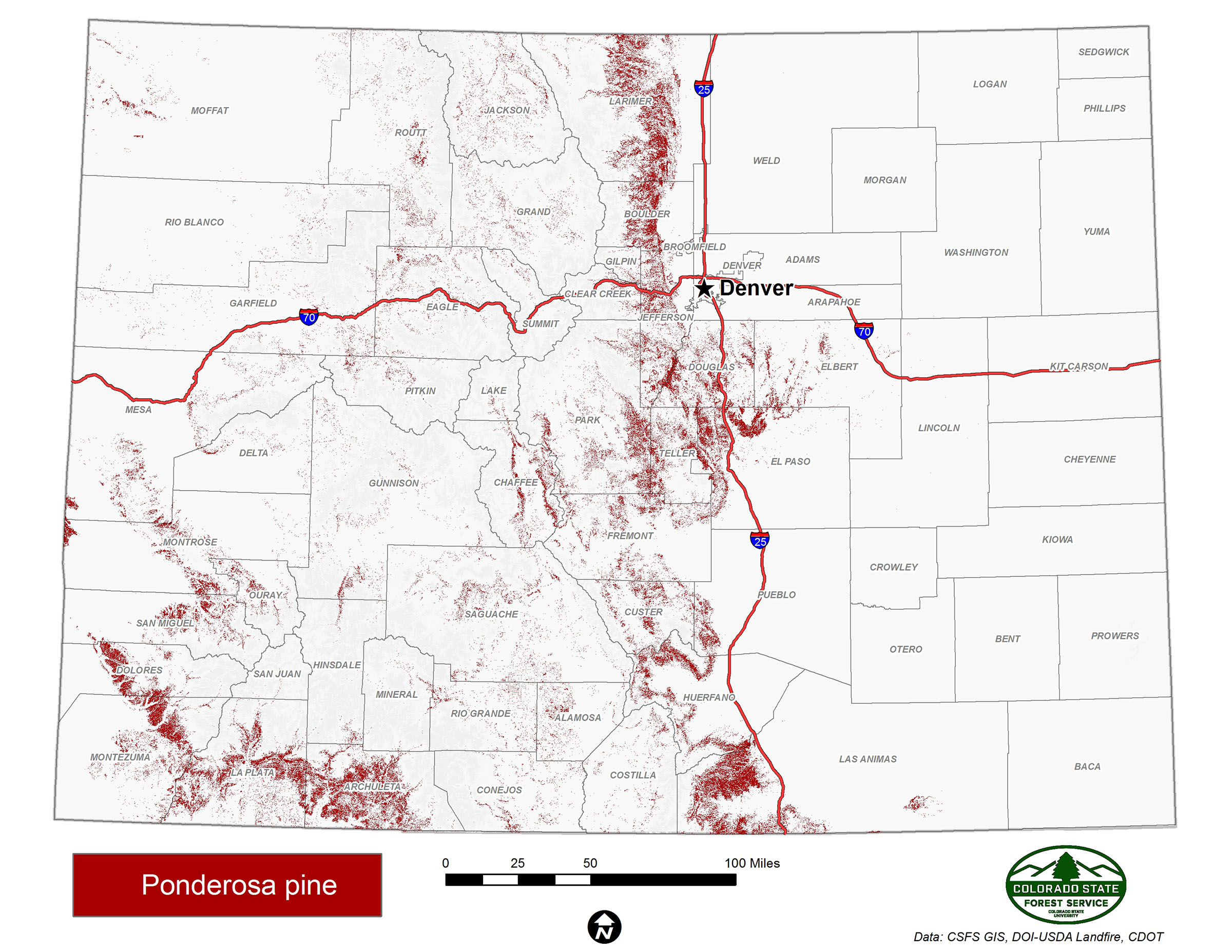
Ponderosa pine is well adapted to high temperatures and low moisture and is highly resistant to low-intensity fire. Although ponderosa pine is most common between 6,000 and 9,000 feet, it begins to appear on the landscape around 5,000 feet where prairies and shrublands transition into open ponderosa pine forests. Ponderosa pine is generally the dominant lower timberline species in Colorado’s montane zone.
A long taproot helps the drought-resistant pine obtain adequate moisture and also decreases its chances of being uprooted by strong winds. Ponderosa pine generally evolved with a natural cycle of frequent, low-intensity fire, which eliminated competing conifer seedlings but allowed mature pines to survive.
Threats to Ponderosa Pine Forests
The advent of aggressive fire suppression has resulted in increased encroachment of shade-tolerant Douglas-fir (Pseudotsuga menziesii) in the understory of ponderosa pine stands. When fire occurs in these mixed forests, the understory Douglas-fir tend to carry fire in ladder fashion into the pine crowns, making the fire much more likely to reach unnatural, stand-replacement proportions.
Importance of Ponderosa Pine to the Community
Because it is more accessible than other species, and largely in private ownership, ponderosa pine has been an important source of lumber and other wood products (Benson and Green 1987)1.
These forests currently are a significant resource for recreation and water supply. They also are the backdrop for the majority of the state’s wildland-urban interface communities.
Learn More
Text Citation
1Benson, R.E., and Green, A.W. 1987. Colorado’s Timber Resources. Resource Bulletin INT-48. Ogden, UT: U.S. Department of Agriculture, Forest Service.
Data Sources
NatureServe. 2018. International Ecological Classification Standard: Terrestrial Ecological Classifications. NatureServe Central Databases. Arlington, VA. U.S.A. Data current as of 28 August 2018.
2017 Colorado Wildfire Risk Assessment, Colorado State Forest Service.