Rural FIA


The national Forest Inventory and Analysis (FIA) program of the USDA Forest Service (USFS) has been in continuous operation since 1930. The FIA Program is an annual survey of our renewable resources, inventorying thousands of permanent plots each year to detect change and provide updated data. In addition to determining the vigor and volume of live trees, foresters also assess plant diversity; fuels and potential fire hazard; condition of wildlife habitat; tree mortality and risk associated with wildfire, insects or diseases; biomass; carbon storage; forest health; and other general characteristics of forest ecosystems.
Traditionally, this inventory has been conducted in a rural setting. However, with the provisions set forth by the 2014 Farm Bill, an additional component accounting for urban forests has been added. The decision to incorporate urban forests into the inventory will help provide a more holistic understanding of our nation’s forest resources and the benefits they provide to almost every facet of our lives.
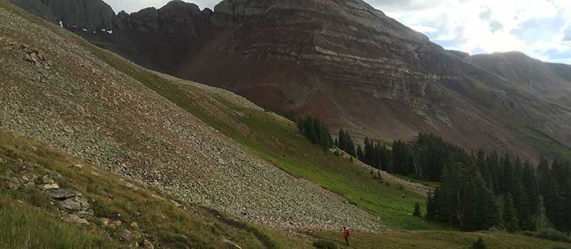
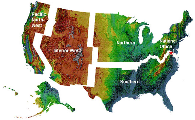
The national program consists of five regional FIA units: The Pacific Northwest, Interior West, Northern, Southern, and the National Office. The Interior West FIA (IW-FIA) unit, part of the USFS Rocky Mountain Research Station, conducts and continuously updates a comprehensive inventory and analysis of the present and prospective conditions of the renewable resources of the forest and rangelands of the Interior West. The Interior West includes inventories in Arizona, Colorado, Idaho, Montana, New Mexico, Nevada, Wyoming and Utah.
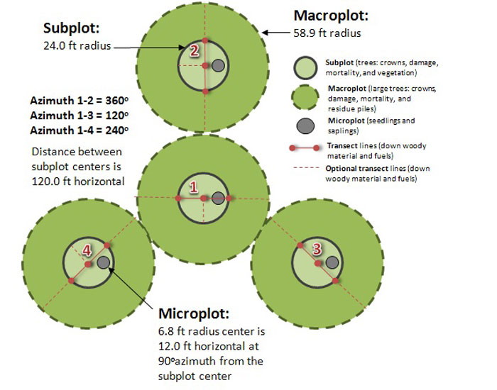
The Farm Bill of 1998 mandated a change in survey procedures and integrated the Forest Inventory and Analysis (FIA) program with the similar Forest Health Monitoring (FHM) program. To reduce bias and ensure that the data collected is significantly sound, a hexagonal lattice framework was laid across the conterminous United States. Each hexagon is spaced 3.27 miles apart from center and is approximately 6000 acres in area. A FIA plot is systematically located at the center of each hexagon without regards to landscape features or land ownership. By also incorporating older generation FIA and FHM plots allows us to preserve the historical data and track change over time. Once these plots are located, there are two phases to conducting the FIA program.
Phase 1 (P1)
This phase involves office work to remotely determine which plots are potentially forested. As the plot locations are essentially random, it is inevitable that plots fall in open areas such as water, agricultural fields, open meadows, and parking lots. These non-forested plots are removed from the survey, while plots that are potentially forested are then sent to the next phase.
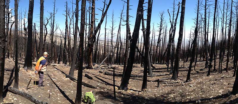
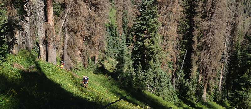
Phase 2 (P2)
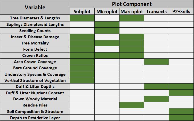
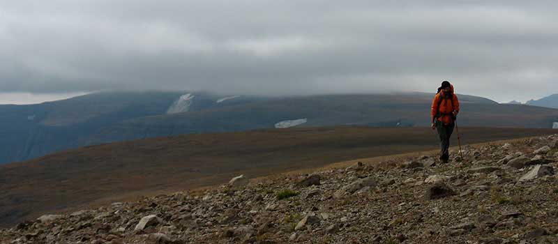
The plots that make it through P1 are then visited by field inventory crews. Once on site, experienced crews determine if the plot location qualifies as forested land. To be considered forested, FIA protocols require the area to be at least one acre in size, 120 feet wide, and 10% canopy cover of qualifying tree species. If a plot is forested, they then proceed to establish the plot and collect data on numerous variables. Information on plot design and the data collected can be found under Data Collection located below.
Phase 2 + Soils (P2 + Soils)
P2+soils plots are a subset of P2 plots on which additional data on soil composition, depth to restrictive layer, and duff/litter nutrient content are collected. For information on these P2+soils variables, please see Data Collection below.
As part of the National FIA Program, each region collects the same core set of variables. Additionally, each region has the option to collect additional variables to address specific policy questions, research studies, and changes in ecosystem services. Examples of variables include, but are not limited to, the following: