

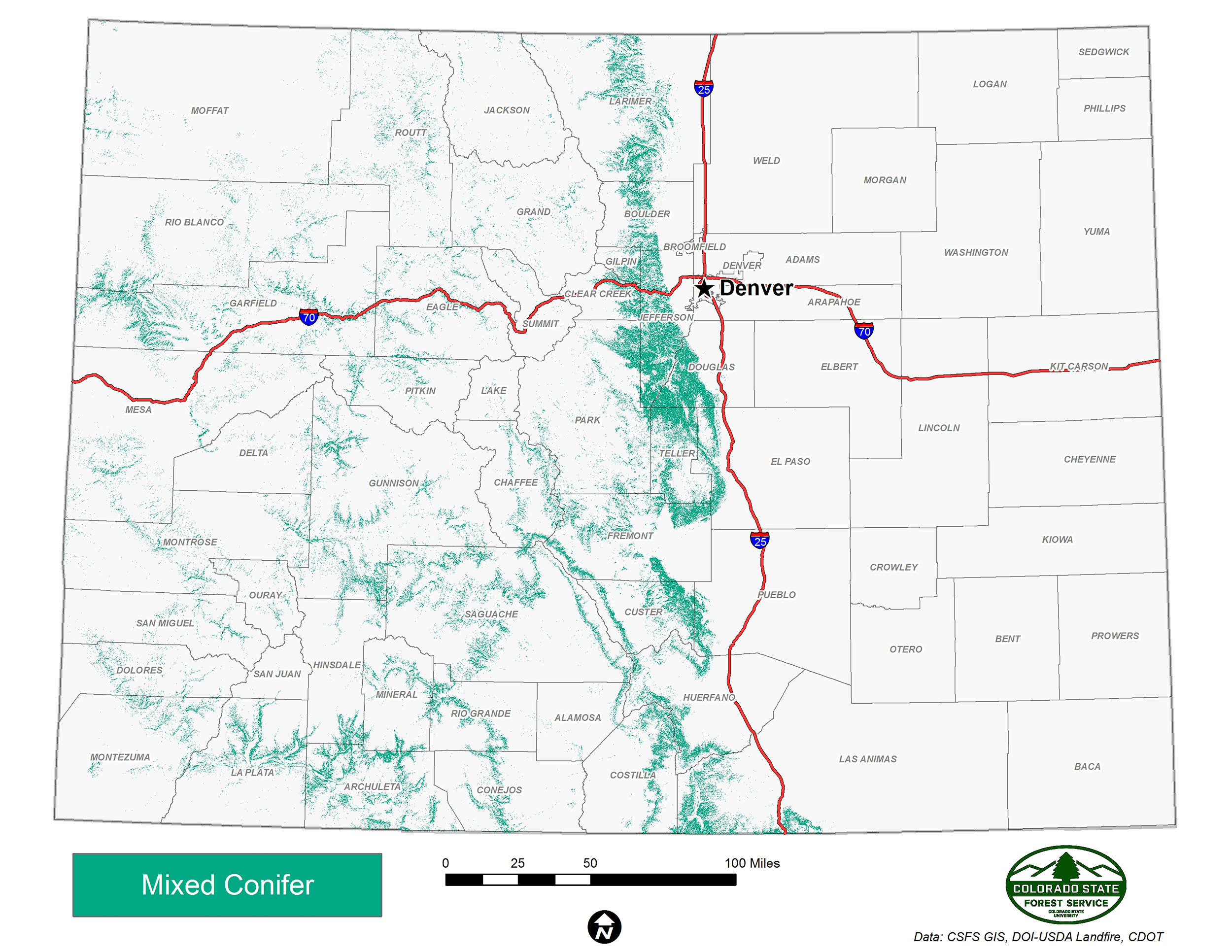
Mixed Conifer
The mixed-conifer forest type occurs at approximately 6,900 to 10,500 feet in elevation, nestled between lower-elevation forests such as ponderosa pine and higher-elevation subalpine forests such as spruce-fir. Colorado has 1.8 million acres of mixed-conifer forest.
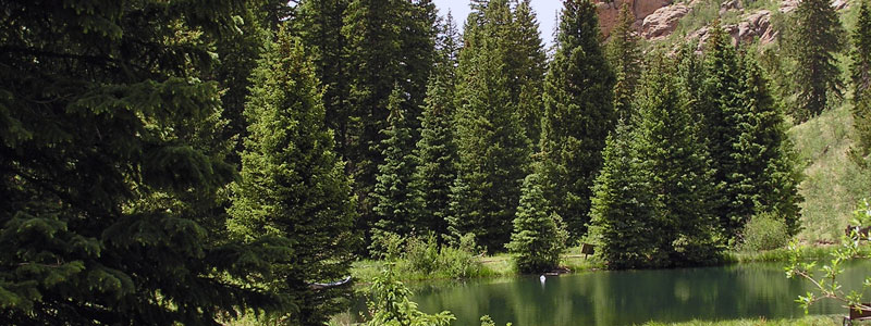
As its name suggests, the mixed-conifer forest type includes a diverse range of species. The distribution and structure of mixed-conifer forests are strongly influenced by temperature and moisture gradients, in addition to soil types and fire. White fir often dominates as the climax species on moist sites and in the southern part of the state, while ponderosa pine, Douglas-fir or Rocky Mountain juniper tend to be the climax species on warmer and drier sites. Engelmann spruce, blue spruce, subalpine fir, bristlecone pine and limber pine also may be present in the mix.
Click on the map to view full size
Changing Fire Regimes
Fire regimes in mixed-conifer forests vary by site, but generally are of low frequency and mixed severity, ranging from 20-year cycles to 150 years or more depending on moisture and elevation. As a result of fire suppression, many mixed-conifer forests currently are denser and contain more dead fuel than they did historically. These heavy accumulations greatly increase the chances for high-intensity, stand-replacing crown fires. Prior to human settlement, these stand-replacing fires would only occur every 200 to 500 years.
Importance of Mixed Conifer Forests
Mixed-conifer forests are important for watershed protection and recreational and scenic opportunities. These forests provide many wood products manufactured by local Colorado businesses.
Compared to other forest types, the value of mixed-conifer forests for wildlife is not well understood. However, many neotropical migratory songbirds breed in mixed-conifer forests and elk use them extensively during calving season and in summer.
Learn More
For more about high country forest types, see the 2008 Report: The Health of Colorado’s Forests (9.5 MB PDF).
Data Sources
NatureServe. 2018. International Ecological Classification Standard: Terrestrial Ecological Classifications. NatureServe Central Databases. Arlington, VA. U.S.A. Data current as of 28 August 2018.
2017 Colorado Wildfire Risk Assessment, Colorado State Forest Service.