For information about wildfire smoke and air quality, visit Colorado Air Quality.
Firefighters clean up tree limbs in Aspen Acres Fire, Aug. 8, 2026. Photo: InciWeb
Swiss Roll Fire, Sept. 10, 2026. Photo: InciWeb
The Colorado State Forest Service helps residents and communities prepare for wildfire. The CSFS does not track specific information about current wildfires, fire bans or restrictions in Colorado. Use the following links to find updated information.
Wildfire information
The following agencies provide information about current wildfires in Colorado:
Just under half of all Coloradans live in the wildland-urban interface and are at risk from wildfires.
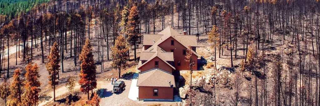
Wildfire is a part of nature in Colorado. Grasses, shrubs and trees provide fuel for fires. If your home is located in or near natural vegetation, you live in the wildland-urban interface and are at risk from wildfires. Planning ahead and taking action can increase the likelihood your home survives when a wildfire occurs.
Learn the actions to harden your home against wildfire and create defensible space.
Know your wildfire risk, how to reduce your risk and steps to be ready to evacuate during a fire with Live Wildfire Ready.
After the Cold Springs Fire. Photo: Wildfire Partners