

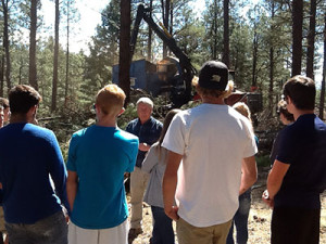
PAGOSA SPRINGS, Colo. – Students from Pagosa Springs High School, under the direction of their science teacher, J.D. Kurz, conducted research on the forest health at a local landmark and recently presented the results at a public information meeting to the town council.
The students wanted to know if the forest at Reservoir Hill – a prominent site for outdoor festivals and recreation – was healthy and whether, if a major disturbance such as a wildfire occurred, disaster could be prevented.
Reservoir Hill is a highly visible, important area for the town of Pagosa Springs, and the location of the town’s Folk Festival that thousands of people attend annually.
“Reducing wildfire risk in a community starts with education. One of the main goals was to get kids outside to collect data related to a relevant problem in our community,” said Kurz.
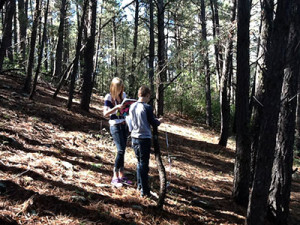
Students Measure Forest Conditions at Reservoir Hill
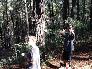
The students calculated the forest density at Reservoir Hill by sampling plots and calculating tree heights, diameter at breast heights (DBH), ground cover, and the amount of biodiversity within the forest. They found the forest to be overcrowded with trees, in a condition that could result in high-intensity, catastrophic wildfire.
The students then proposed a solution to the town council: a thinning project that would reduce the amount of vegetative fuel that could burn, while increasing the forest health at Reservoir Hill.
Because of the long-term monitoring opportunity, the students are able to measure the forest’s ecological response to forest thinning and contribute to an authentic research project.
Kurz says the students’ perceptions of the forest have changed completely after collecting and analyzing data from healthy and unhealthy sections of the Reservoir Hill forest. “One student mentioned that she can’t drive around town without noticing ladder fuels and defensible space,” Kurz said.
“In the wake of recent mega-fires, I wanted my students to be able to recognize forests that are susceptible to catastrophic fire, because many of them live right in the middle of one. The ultimate goal is that students will reduce the wildfire risk around their homes, and that they will evaluate wildfire risk when they become future home buyers.”
Forest Restoration Grant Supports Project
Forest Health Company, in conjunction with the Mountain Studies Institute, the San Juan Headwaters Forest Health Partnership and the Pagosa Springs Parks and Recreation Department, will conduct the tree-thinning project on Reservoir Hill this winter.
The project is possible because of a Colorado Forest Restoration Grant submitted to the Colorado State Forest Service (CSFS). The CSFS, an active participant in the San Juan Headwaters Forest Health Partnership, awarded the state-funded grant to the Partnership for tackling the proposed forest improvement project on Reservoir Hill.
“The project aims to restore forest conditions to a more natural state, which will reduce the likelihood of a serious wildfire or bark beetle infestation,” said Kent Grant, CSFS Durango District Forester.
“This will help keep the forest green and healthy in the years ahead, and make it a safer place for residents and visitors to Pagosa Springs to recreate and attend public events.”
Through their research, the Pagosa Springs High School students helped convince the community about the benefits of the thinning project for Reservoir Hill and the town of Pagosa Springs. The students will continue to inventory and monitor the forest health there to document its response to the thinning project, and measure the impacts to the forest’s health over time.