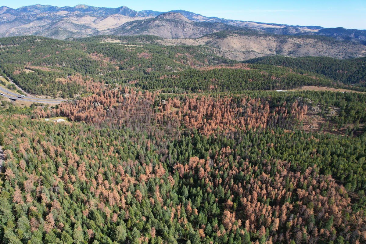
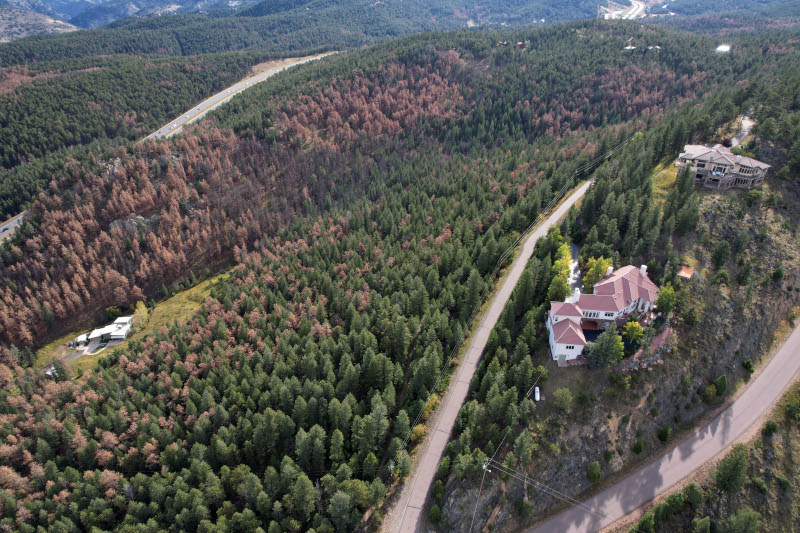
Discover data and analysis about Colorado’s forests and trees.

A CSFS FIA specialist marks a plot in a Colorado woodland

Colorado’s forests are dynamic ecosystems.

The Colorado State Forest Service studies the state’s forests and trees to better understand our forested ecosystems and inform forest management. Through this science-based approach, the Colorado State Forest Service and its partners improve the health of Colorado’s forests and their resilience to wildfire, insects, diseases and climate change.

Science & Data Bytes

screenshot of the Wildfire Risk Viewer application that contains a digital map of Colorado and a legend.

Surface and Canopy Fuels in the 2022 CO-WRA Update

The Colorado Wildfire Risk Assessment (CO-WRA) is a statewide geospatial analysis designed to increase wildfire awareness, provide comprehensive data and information concerning wildfire risk and local fire history and educate users about wildfire risk reduction and hazard mitigation resources available from the Colorado State Forest Service (CSFS) and partner organizations. The 2022 CO-WRA update was released on July 17, 2023.

Type your address or the city or town where you live into the search field on this map.

Map powered by the Colorado Forest Atlas from the Colorado State Forest Service