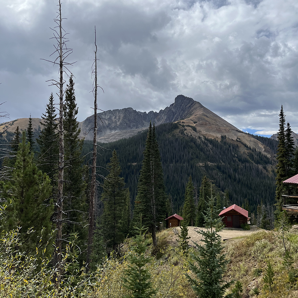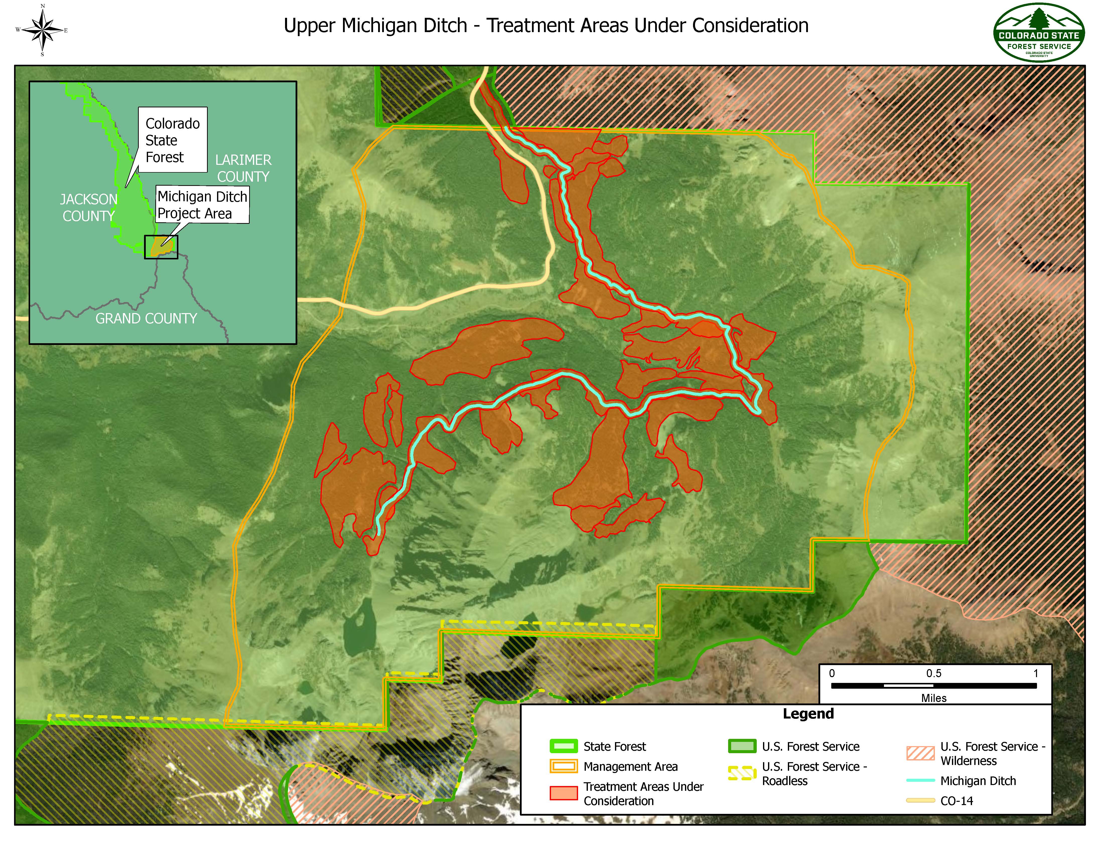
The Colorado State Forest Service and the City of Fort Collins are partners on a new project to protect the source of 25 percent of the city’s drinking water. The Upper Michigan Ditch project encompasses 150-plus acres located on the Colorado State Forest in southeastern Jackson County, stretching from the Nokhu Crags to Cameron Pass on Colorado Highway 14.
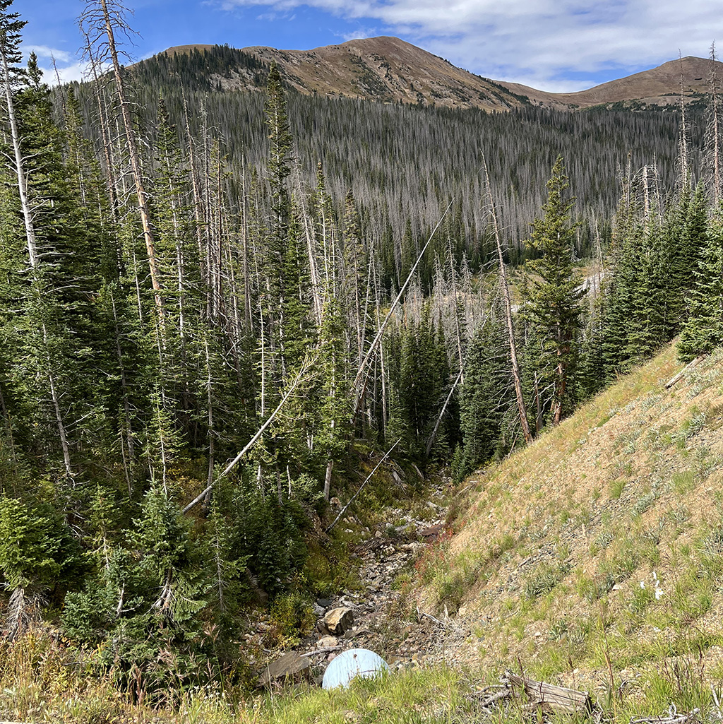
The Upper Michigan Ditch provides a quarter of the City of Fort Collins’ drinking water, and that represents a $1.7 billion value at risk from wildfire. In the early 2000s, an outbreak of spruce beetle killed a large quantity of spruce trees in forests around the ditch, resulting in increased susceptibility to catastrophic wildfire. The ditch was threatened by the 2020 Cameron Peak Fire, which burned within two miles of the facilities and underscored the need for action to protect this critical infrastructure.
The CSFS and the City of Fort Collins have identified several potential impacts from an uncharacteristic wildfire burning near the Upper Michigan Ditch:
- degraded water quality
- reduced water quantity
- damage directly to the ditch by literally eroding off the side of the mountain
- loss of historic employee housing and facilities
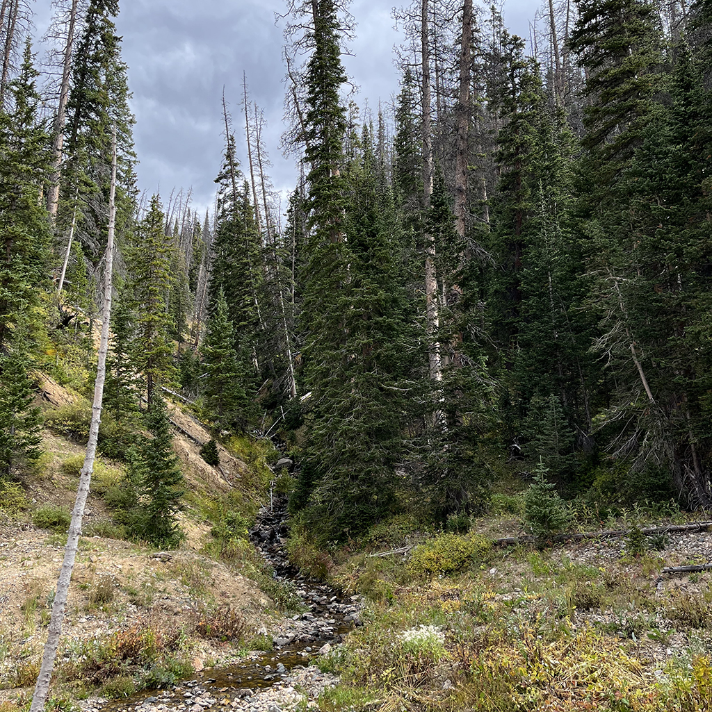
As of July 2023, the project is in the planning and development phase. Protecting the Upper Michigan Ditch will be a challenging undertaking. The ditch and associated structures sit at an elevation of 10,400 feet, where harsh weather is commonplace and the terrain is extremely steep and mountainous. This location limits the times when actions can take place, and it requires specialized equipment. CSFS staff had to be innovative and use the latest technology to put an effective plan together. To adequately reduce fuels along the ditch and structures, foresters will use forest management tactics such as helicopter logging, steep-slope tethered logging and conventional methods. They’ll also use LiDAR technology to identify access routes and locations requiring different tactics to reduce fuel loads. Merchantable logs will be sold to both offset the cost of treatment and serve as a carbon sink as durable wood products.
The City of Fort Collins will partially fund the project, but it will also apply for funding from the Forest Restoration & Wildfire Risk Mitigation grant program and other sources. To mitigate potential erosion impacts following treatment, the CSFS and City partnered with the Colorado Water Conservation Board to identify locations where erosion control features could be installed. Colorado Parks and Wildlife will provide expertise to address recreation concerns.